Wednesday, October 29, 2008

The Falls at Dunloup Creek

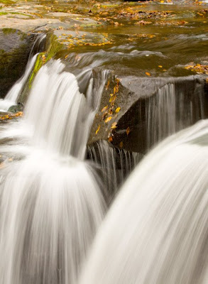
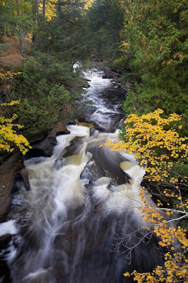
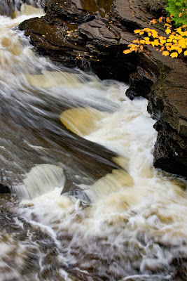
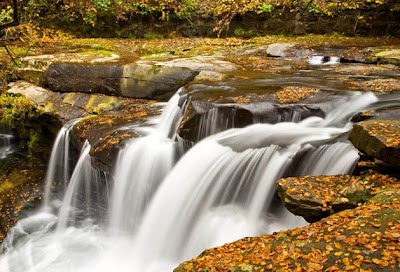
One of my goals for this trip was to find great fall scenes. I paid particular attention to the creeks and rivers hoping to find something that I could do really creative things with. When I first saw the waterfalls at Dunloup Creek in the New River Gorge National River area, I could hardly get out of the car fast enough. At first I was frustrated because there were branches in the way of my view and I did not immediately see a way to get a clear view. Henry found a way that I could get the views I wanted.

While I did not shoot in any particular order, my goal was to get the big picture and then to find ways to photograph smaller portions of the fall in a more intimate view.

I used my 24-105mm lens with a polarizing filter to get the "big picture." I had it set at 35mm rather than the full 24mm wide angle because there were distracting elements that I did not want in the photo.


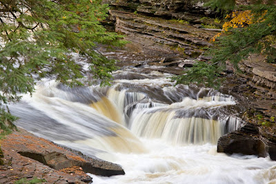
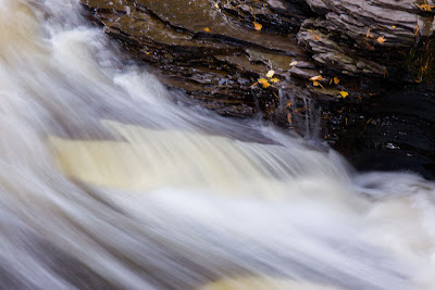
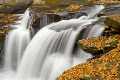
I zoomed in for a closer view at 47mm:


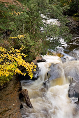
I changed to my 100-400 and moved the polarizing filter over. This one was shot at 100mm:


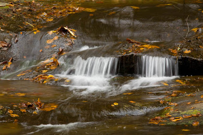
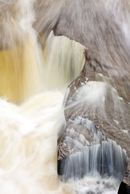
Now, look back at the "big picture." Do you see that very tiny double waterfall at the top. With the 100-400mm zoomed out to 320mm, that small cascade takes on a life of its own.


I probably spent an hour or more here, trying to find all the possible compositions. While none of these images are HDR, I was also shooting for HDR - so each composition had at least 3 exposures to be sure I had gotten the water action I wanted as well as the exposure on the rocks and fallen leaves. I was lucky that the weather was cloudy - so my lighting for this was nice and even. I could not have asked for anything better.

Tuesday, October 28, 2008

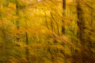
Creative Images


When I'm shooting for these creative images, I take a lot of images that just don't work. I get just enough intriguing ones that it keeps me trying this technique.

This one came from the New River Gorge National Scenic River area. To me this one came out looking a lot like my sister-in law, Mary Solomon's pastel imagery.

Monday, October 27, 2008

Autumn Impressions

I don't have time to do much of a blog tonight - I've got to get up early to do sunrise at a cypress swamp in the morning. But . . . here is another of my "creative" images. I have not figured out a catchy name for them, yet. Hope you enjoy!

Sunday, October 26, 2008

More Michigan Fall Colors

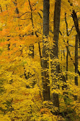
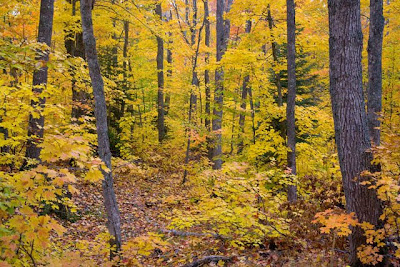
As we drove through the Upper Peninsula, the colors were just gorgeous. Sometimes I felt like I was in a fall fairy land!! Sometimes, the forest just glowed yellow!


These were shot on the road going toward Eagle River. There was color everywhere!


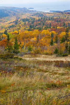
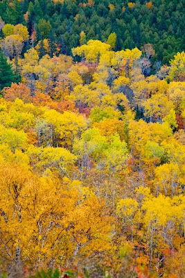
We went up to Brockway Mountain. It is a beautiful drive. The weather was not conducive to great photos - too hazy and dark, but the view of the colorful fall trees and Lake Superior is gorgeous.


Here are some shots at a different angle at the top of Brockway. Even on a dull cloudy day the colors were amazing.


I'm also playing with artistic creative images that you get straight from the camera. I've tentatively named this one: Whimsical Fall.

Presque Isle River - at the Isle

The next day I came back to the Presque Isle. I started at the Island on the bridge. The bridge is a suspension, wooden bridge. Anytime you walk on it, it sways both up and down and a little to the side. As a photographer, I've learned a lot of patience. Sometimes it is waiting for the optimum light as a cloud passes over. This time it was timing my shots when no one was walking on the bridge.

I spent a lot of time here - I wanted to get the big picture shot:


This is actually a large, flowing area, one of the channels around the island. I shot that one with my 28-105mm landscape lens. While it does show the big picture, it also makes this large powerful river look small. Even the large trees in the background don't give a good feel for the size.

I also wanted to find the smaller, more intimate looks.

I pulled out my 100-400mm lens to get a better shot of the rapids at the top of the first image. This is up at the top, you can barely see it in the "big picture."


I changed location on the bridge and was fascinated with the way the river water and the rocks had worn jig-saw puzzle shapes into the bedrock.


I was also looking for places where I could get both the stream action and the hint of the fall colors:


I found this composition illustrated the flowing lines and I still got a fall leaf:


This last shot is a really close up, almost a macro shot:


I won't decide which are my best images from this area until I get home. I'll be looking for which images have all the leaves sharp, rather than the motion blur that occurs as a gentle breeze comes through. I also shot for HDR (high dynamic range) which lets me get good exposures for the brightest areas and the shadowed parts.

Saturday, October 25, 2008

Coal Mining P.S.

We've had internet issues the last few days - our hotel did not have it and we couldn't get Edge for our Sierra Air Card. I wasn't able to get this website to load until this evening here in Knoxville.

Here is one more article with a photo about the mountain top mining in West Virginia.

Warning: It is not a pretty picture!

From The Star, Coal mining ravages Appalachia.

Presque Isle River

One of my favorite areas in the Porcupine Mountains in the Upper Peninsula of Michigan is the Presque Isle River. When we were here before I had hiked the lower stretches of the trail along it. This trip I decided to hike part of the upper portion. I had Henry drop me off by the top fall and I was going to meet him down at the picnic area.

I really enjoyed most of the walk. I got a good look at the Nawadaha Falls which was an easy walk from the upper parking lot, but there were too many trees and tree trunks in the way to get a good photo. I started down the trail. I enjoyed watching flocks of small birds dart from the trail up into the trees as I approached. The forest was beautiful. The trail led me high above the river. Most of the trail wasn't bad, but first I came up on a stretch where I ended up laying my tripod down and using hands and knees to get up. Then the trail had a few more ups and downs. I was doing OK. And then . . . right before I got to the much easier boardwalk . . . I looked down on . . . this:


In general, I go uphill much easier than downhill. Yes, I may get winded, but my footing is much more steady and sure going uphill. Perhaps it is because when you are going up if you fall, you are likely to fall forward with not such a great distance to go or that you can catch yourself with your hands. It might be that my center of gravity is more balanced when I'm going uphill. Whatever the reason, I don't trust myself going downhill and take it very cautiously. So when I looked at that stretch from above, I knew I was in trouble. I didn't take long to decide that going down sitting down was the best course of action. And, it went pretty well. But when I got to the bottom, I realized that I had somehow lost the water bottle from my pocket as well as a small amount of money. There was no way I was going back to the top for that.

Fortunately, another family came along. I casually mentioned that there was an unopened water bottle and some money up there. A very nice young man soon reappeared with my lost possessions. Last time I was at that spot, someone else rescued my lens cap that had fallen where I did not have the agility to rescue it. Seems like I need to be more careful at that location since I keep losing things here. But so far, they haven't stayed lost.

As I was taking my last looks before heading on down the boardwalk, I noticed as sign that warned: Steep and rough terrain ahead! Now they tell me!

The rest of the walk that evening was beautiful. Here are two of the shots I took. I made it back to the car and Henry about ten minutes after sunset, before it got to dark to see the path out of the forest.


The fall colors were gorgeous!

Mountain Top Mining Revisited


Back in June, I posted a blog about West Virginia mining issues. I still read Julie Zickefoose's blog. As well as her usual birding and Chet Baker features, she brings up the current situation with mountain top mining in West Virginia.


She points to this New York Times article which discusses the measures being put in place by elected officials before their terms are up to keep this type of mining activity going.

We just passed through West Virginia. We saw large signs, "Friend of Coal." Now while I DON"T favor cutting off the tops of mountains and filling stream beds to get needed energy resources, I also wonder what the local population really thinks about these issues. We tend to think of mining corporations raping the land for corporate profits that then line already rich people's pockets. What we don't also remember - mines require laborers. Coal workers are a vital part of West Virginia's economy. Coal mining in underground mines has its dangers to mine workers as well as environmental issues that I certainly am not well educated about. But in an economy that is losing jobs right and left, I can understand a coal miner trying to feed his or her family that is worried about whether his job will survive.

Upon researching Friends of Coal, it appears to be a coal industry group. While I found some interesting and positive information about new things related to the ways that coal can help our energy problems, I also found some other websites with information as well.

Apparently today's realities - due to modern mechanism, it takes fewer workers to mine the much larger amounts of coal today. Of course, mountain top mining takes even less workers than more traditional underground mines.

I would like to live in an ideal world - where mining companies, the workers, and the environmentalists could all be working toward the same goals.

Some of the sites I looked at in addition to Friends of Coal are:

Treehugger

Appalachian Greens Be sure to read down to J Pratt's comment. It represents "the other side" to this issue.

The stream up at the top is a tributary to New River in West Virginia. It is part of the protected New River National Scenic River. West Virginia is a beautiful state. I know that we will need coal as a natural resource, but surely we can find ways to extract coal without ruining the beauty and ecology of a beautiful part of our country.

Wednesday, October 22, 2008

Creative Photography

While I love to try to take beautiful, natural photos, I have been playing with some creative techniques.

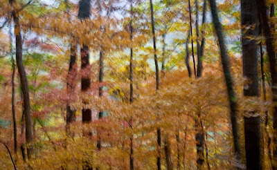
This first photo is actually a multiple exposure. With Nikon cameras you can do this "in camera." With Canon, I took a series of about 10 photos, moving the camera up just a tiny bit for each shot. Then in photoshop, I add each one as a layer reducing the opacity to about 10%. I also added a solid color layer to provide a base.I played with the colors from yellows to greens to see what best brought out the colors in the photo. I could probably have done the same thing by making the bottom layer 100%.


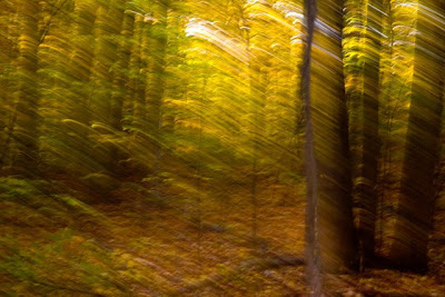
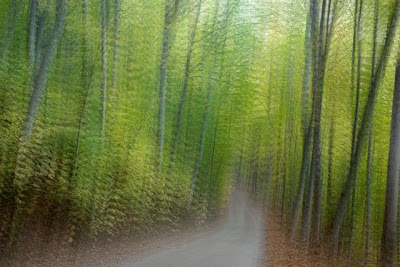
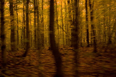
The next photo is done with a technique where you set you shutter speed and take photos as you are moving along the road. Yes, you must have someone else driving!!!! We have not figured out the exact "perfect" speed and I use a range of shutter speeds. I end up with a lot of shots that need to go straight to the rubbish bin. But . . . I end up with some that I really like. We've been in a lot of forests this trip, so you can expect to see more of these artistic shots over the next week or so.

This one was taken in Michigan. The only thing I did to this was an adjustment to the color balance to bring out the fall colors better.


I suspect that some of you will love these. I'm sure there will be some who won't like them. But each one is unique and I've had a lot of fun playing with this technique and seeing what comes out.

Tuesday, October 21, 2008

Lighthouses

I love lighthouses. They are usually beautiful, but I think it is their symbolism that resonates in my spirit. They were built to guide sailors either away from hazards or into harbors. I was in Michigan for fall foliage, but I was near two lighthouses near sunset.

The Manistique Light is right on the edge of the jetty that leads into the harbor. The day had been cloudy all day long, and right at sunset the sky cleared. I like to find ways to photograph lighthouses where you can see the light. There is a trick to have your camera ready and then with a long enough shutterspeed to hit the shutter right as the light comes around and a long enough shutterspeed so that the shutter is open as long as the light is on. I have also found that it has to be dark enough for the light to show up. When you can catch that light, often you get a natural lens flare that accentuates the light.


As a traveling photographer rather than a local photograher, I often only have one opportunity. Sometimes the weather and lighting cooperate, sometimes they don't. On this evening, the clouds were not conveniently behind the lighthouse, but there were some pretty clouds after the sunset. I also took cloud photographs.


To combine the two images, I first made a new layer from the background, Layer 0. Then I did a select all and copy and pasted the cloud image which created a second layer. I put the lighthouse layer above the layer and did a layer mask. Using the quick selection tool, I was able to select most of the sky, but by using a mask, I can go back in and clean up the edges with a soft brush. I also used the move tool to move the clouds up above where the lighthouse was. Using a layers adjustment I was able to match the color tones of the sky with the sky color inside the lighthouse. The finished product looks natural and is more artistically pleasing to me. If I market this image, I will market it as digitally altered.


I also had the opportunity to photograph the Eagle Harbor Light. It was overcast, but I spent some time photographing it, hoping the sun would find a slit to light up the clouds behind it. When I was doing my conversion from RAW, I added a little more red tones.


I had taken sunset photos at Manistique as the sun was turning the clouds in the distance a pretty pink.


I was able to combine these two photos. It took a little bit of trial and error, playing with it -using levels to adjust both photos so that the sky colors matched.


I am hoping to find a way to brighten this one up so the lighthouse shows up better. It is not lit at night. But somehow the water's color works with the cloud background. I like this version better. I could wish to be there again sometime when the natural surroundings - the sunset colors produce a masterpiece photograph. But it is fun to create something artistic out of the materials you have at hand.

Saturday, October 18, 2008

Michigan's Fall Colors

We spent several days driving around the Upper Peninsula looking for fall colors. We were lucky to catch them so close to their peak. I love the bright, deep reds, the brilliant yellows . . .


Friday, October 17, 2008

Manistique River

Northland Outfitters in Germfask is one of our favorite places to stay in the Upper Peninsula of Michigan. We've been there twice before in our RV. This year we didn't bring the RV so we stayed in one of the camper cabins. The view of the Manistique River is just gorgeous. We had a nice cloudy day, so I pulled out camera and tripod.

I was shooting with my standard lens, the 28-105mm Canon L lens. When I looked at the shots that night, I was not too happy. This was just not a good representation of what I was seeing with my eyes.


So I began to play with it . . .

The first step . . . cropping it down.


I've been playing with some programs from Topaz labs - Topaz Adjust and Topaz Vivacity. For this one I used the Simplify portion of Topaz Adjust and used the sharpen with iterations in Topaz Vivacity to create this finished piece:


Using what I learned from the crop of the photo, I went out the next day with my 100-400mm Canon lens to get the photo I wanted at full resolution:

Thursday, October 16, 2008

Horicon Marsh

When we left St. Louis after Archon, we headed north to enjoy the fall foliage. On our way to Michigan, I saw Horicon Wildlife Refuge on the map near our route. We jogged over to explore. I've learned that National Wildlife Refuges are usually worth a stop. I was pleased with our visit to Horicon.

Horicon is a natural marsh created by the glaciers from the ice age as they carved their way along the bedrock. Horicon Marsh is the largest freshwater cattail marsh in the United States. It has been listed as a Wetland of International Importance. Five miles wide and 13 miles long, it is an amazing place. It is a joint venture between the state of Wisconsin -the Wiconsin Horicon Marsh State Wildlife Area and the US Fish and Wildlife Service - Horicon National WIldlife Refuge.

I started on the south end, the Wisconsin Horicon Marsh State Wildlife Area. There is a 1 1/2 half mile hike that leads you through forested areas , right along the marsh, and near several bodies of open water. It was my first hike in a long time and it felt SO good. I saw a warbler,singing sweetly in the treed areas. I saw Canada geese and a sandhill crane fly over. A little later a flock of white pelicans kettled overhead. I love to watch as they fly in circles gaining height - their white wings flashing as they turn. White egrets are a threatened species in Wisconsin, but I got a good look at one in flight. I took my binoculars, but not my camera on this expedition - the weather was gray and I just wanted to enjoy the hike.

When I got back to the car, we drove up to the overlook - the marsh looked like a long grassy sea. I learned a new word at Horicon as well: drumlin. Drumlins are elongated hills created by glaciation. At Horicon, these hills look like islands of trees in the long marsh.


As we continued our journey north, we drove over to the Visitor Center at the National Wildlife Refuge. A very helpful volunteer showed me how to get to some great birding areas on roads I would have missed. She also told me about the floating board walk. We headed over there. I did the walk with my bird book and my binoculars.

This is Henry's photo of me as I was walkkng the floating boardwalk.


Horicon was known as a major nesting area for redhead ducks. I was hoping to see one, but I think they had already migrated south.

We spent about half a day here. What a delightful place! I would like to come back and spend more time exploring this area.

Friday, October 10, 2008

Galveston Island State Park

I can't remember the first time I visited Galveston Island State Park, but I suspect it was when my kids were very little. I do remember that we visited before Hurricane Alicia in 1983. I'm pretty sure we stayed there in our van camper. The first time we went, I remember thinking how tall the dunes were, you could not see the beach or waves from the camping and picnic areas. However, I vividly remember going back to Galveston Island State Park after Hurricane Alicia. The storm had swept all the dunes away. There was a beautiful view of the waves and beach from the campground! The dunes were totally gone! That was amazing to me at the time and something I didn't forget.

When I was thinking about the "before" pictures I wanted to take, Galveston Island State Park was high on the list because I did remember what Alicia had done. Unfortunately, we had been running the air conditioner in the car as we drove from the east side of the island to the park on the West End. My camera lenses kept fogging up, giving these photos a dreamy look. It may be appropriate . . . Hurricane Ike did a lot more damage than Alicia!

When I got to the park the morning before Ike, it was already closed. Maintenance workers were emptying trash and cleaning up. I ducked under the barricades and walked over to get my photos. You can see the shelters on the right.


Here is a closer view of one of the shelters. Note how high the dunes are behind them. You certainly can't see the water. However, when you look at the photos after Ike, there is not only a clear view, the shelters have been badly damaged.


There were two dune fences used to help keep the dunes in place - one on either side. The dunes were covered with vegetation that also helps keep dunes from shifting and being washed away. The flowers were blooming, it was a pretty sight.


I walked over to the walkway over the dunes. You can see part of the dune fence.


The Texas Parks and Wildlife department has posted photos of Galveston Island State Park after Ike.

Here are some of the ones that really give you a good idea of what this powerful storm did:

The "new" beach

Damaged shelters

The new view

Debris piles

More debris

The bathhouse

This park is close enough to the Houston metropolitan area, that hopefully it will be rebuilt . . . but for now the the official Galveston Island State park site says the park is closed until further notice. According to the October 1st Texas Parks and Wildlife Press release most of the state parks affected by Hurricane Ike are back up and running. Obviously, Sea Rim and Galveston Island sustained severe damage. It will take longer to rebuild. I've also heard that Sea Rim may not open back up as a state park become a state wildlife area instead. That makes me sad . . . I hope that the state will find the funds to rebuild the facilities at Galveston Island State Park. We need our state parks!

Monday, October 06, 2008

P.S. Ike Storm Chasers

One more link: more storm chaser reports and photos.

This link takes you to a page where several storm chasers who came to Galveston for Ike reported. Amazing . . .

Several of them also weathered the storm in their vehicles. Not my cup of tea, but they do collect data to help predictions for future storms.

Hurricane Ike's Science Researchers

It took awhile for me to relocate the article about the storm researchers who braved Ike's wind and storm surge.
This Galveston Daily News article about Rachel Humphrey who had come from Colorado to do storm research has just amazed me. I can not imagine weathering a storm like Ike on a truck (however large and sturdy) on the causeway. While I did think it wise that they parked where they could get to higher ground, the life raft as a last resort sounded very scary to me in the midst of a hurricane with such a powerful storm surge. The other reports say the truck was 35 feet above sea level - that's a little better, but still, talk about being in harm's way!

I'm sure that we took photos of one of these big research Doppler on Wheels trucks, but I did not bring my master set of photos from Ike with us on our current trip. Here is a Photo of Doppler on Wheels from the Center for Severe Weather Research site.

Here is a link to the Information gathered by the DOW as well as another article about the storm researchers in Galveston

This link to the Storm Chaser website has another set of dramatic storm photos and stories of storm chasers - including photos of the rescue of the men who weathered the storm at the very damaged fishing pier.

Saturday, October 04, 2008

Shelfari - social networking for book lovers

Shelfari was also mentioned today. The way it was described - a Facebook for books. It describes itself as a "Virtual Bookshelf." Each member gets a "bookshelf" to put their books on. You can write reviews, meet people, etc. From one of the audience remarks, it sounds like an online way to catalog the books you own.

Stumbleupon

At one of the panels today, I learned about the website: Stumbleupon.com It is definitely a creative way to surf the web.

This website takes you randomly to other websites. You can target a subject or topic to surf or just randomly see what comes up.

While some of the sites it took me to were definitely not my taste, there were a few that were either fun or interesting:

Man in the Dark

Sketch Swap A lot like Etch a Sketch

Warning: Stumbleupon could be addicting . . .

Inaccurate Ike headlines

The Associated Press has an article today that talks about people who died due to Ike. While I am more than glad to read and grieve with the families over this loss of life - I hate the headline:"Islanders who insisted on staying died in Ike." For one thing, the death count from Ike is still officially very low given the size and unusual strength of this Category 2 storm. On Galveston Island, the count of people who stayed has been put in the wide range of 2000-15,000 people. Most of these people survived. However, I've seen a report that said there were 940 rescues made the morning after the storm. But I do find this headline to be very misleading.

However, there are still a number of people who are missing throughout the most severely damaged areas and many may never be found. This story does an excellent job of telling the story of some of the people who did die because they either did not evacuate soon enough or because they did not evacuate at all. And it is a good warning for people to be more careful the next time a major storm heads ashore.

Archon - The Secret Life of Hugo Mitty

We're in Collinsville, Illinois attending Archon 32. There are so many things to see and do at a science fiction convention. While I was sitting working on yesterday's blog, one of the actors from the play to be presented came by to round people to see the performance which was about to start. Since I love watching live performances, I headed in.

The play???? The Secret Life of Hugo Mitty. Based upon a short story written by James Thurber in 1939 this play went a different direction from the 1947 movie with Danny Kaye as Hugo. In the original Hugo Mitty was a proofreader for a magazine publishing firm. As Hugo does his mundane work, his mind creates a world where he is heroic, poised, self assured, and the master of his fate. Depending on the cover, he might be a western hero or a World War II fighter pilot. In the original story he has the opportunity to rescue the girl of his dreams and ends up living a much more vibrant life than before. This character made such a impact on the culture of the time that the name came to represent day dreamers.

The Trans-Iowa Canal Company Players here at Archon took this character and put a modern spin on it. Hugo Mitty worked in a large store modeled after the BnL store in the movie Wall-e. The actors do a great job moving Hugo from his real world job into his fantasy world as he goes through his day. The villain, the Joker comes from Batman lore. This version had so many references to other movies and science fiction stories that really added to the humor.

The cast had obviously put a lot of work into this production complete with sound effects.

What a fun way to spend some time!

Friday, October 03, 2008

USS Flagship Hotel - Pleasure Pier


The earliest roller coaster near the future site of Pleasure Pier seems to be one built in the 1880's. News reports talk about complaints made because it frightened horses pulling carriages with ladies and children. 6000 feet of lumber, one ton of railroad iron, 200 lbs 6 and 7 inch bolts, and four cars all in working order was mentioned in an advertisement when it went up for sale. The final report, the City Railroad company removed the roller coaster because it was never a success and was always an eyesore.

I think this link is an old postcard from the early 1900's showing the roller coaster that I think is Mountain Speedway. It was said to be " lit up at night like a city blazing in the darkness." Here are two other links to a different postcards of the Mountain Speedway and the Galveston seawall.

I found still another roller coaster photo supposedly from 1909.

Back in 1912, forward thinking city promoters dreamed of an amusement pier similar to the one in Atlantic City. Time passed by, but in 1931, plans were drawn up for a 700 foot pier with an auditorium. Construction did not start until right before World War II.

Pleasure Pier
The Reconstruction Finance Corporation was started by Herbert Hoover in 1932 (think shades of today's financial chaos.) From 1932 until 1941 it disbursed $9.465 billion. I can't imagine what that dollar amount would be in today's currency. The RFC loaned $1,100,000 that was combined with $350,000 from the city that began construction. World War II caused another delay. By 1944, the pier was almost completed, but it did not fully open until after the war in 1948. The new pier was four blocks long with a ballroom, an outdoor theater, a snack bar, and a T-head fishing area. This post card of Pleasure Pier ca 1945 gives us a glimpse of how grand it was.

Unfortunately, it was not profitable and Galveston defaulted on its payments earning the name: "Galveston's White Elephant."

Hurricane Carla damaged the buildings but not the structure of the pier in 1961.

Houston businessman James E. Lyon negotiated for the pier in 1963, paying the government $179,000 for the defaulted bonds (amazing with the accumulated interest these bonds had a face value of $2,300,000.) I don't quite understand the financing here, but Galveston gave Lyon $2,000,000 in new bonds in exchange for those old bonds and issued another $1,800,000 bonds to Lyon. Lyon agreed to pay Galveston $185,000 annual rent for forty years which would pay off the bonds. When the bonds were paid off, Galveston would own the hotel. With these funds, the Flagship Hotel was built. (Information from "Galveston A History" by David G. McComb)

Each room had an ocean view with great sunrise and sunset vistas . . .

The hotel has fallen on some hard times. In 2004, the operator of the hotel, Daniel Yeh filed for bankruptcy. He has been convicted for fraud with regard to lodging for Hurricane Katrina victims. The more recent reviews are not that favorable siting the hotel as dated and in need of renovation. But even so, many reviewers enjoyed their stay in spite of the poor conditions because of the great views and the pleasure of being over the ocean.

The damage to the Flagship from Hurricane Ike was worse on the eastern side. It is quite possible that when the Balinese Room, Murdoch's and Hooters were demolished that there was a lot of flying debris - or that the structures or large parts of them were airborne and hit the Flagship. Note the damage to the front facade and the entire first floor. To my laymen's eyes, the pier structure still looks sound and the damage seems to be to the facades of the hotels rather than the internal supporting walls.


The auto ramps were completely washed out. I am guessing that the wave action hitting against the seawall and bouncing back would be more damaging than just the incoming waves. Hopefully the pilings under the hotel are still structurally sound. I believe that one of the other hurricanes also damaged these ramps.


While there is damage to the sidewalk area of the seawall here and the rip rap, (the large boulders used to protect vertical walls like Galveston's seawall from being undermined by wave action) most of the seawall itself is intact. (There was damage to the seawall on the far west end of the island from the storm surge. That has happened in other hurricanes and is repairable.)


Tilman Fertitta bought the Flagship Hotel and pier from the City of Galveston. Before Hurricane Ike, the plan was to restore the hotel and the pier. Planned improvements included a wooden roller coaster and a Ferris wheel. The transition of management of the Flagship Hotel from Daniel Yeh to Landry's should happen shortly if it has not already.

According to their website, the Flagship hotel hopes to reopen in January. I've been a property owner at the San Luis, one of Fertitta's properties in Galveston for about ten years. His demand for quality, high levels of customer service, and his history of success make me think that the Flagship Hotel will rise to new levels of greatness under his management. I look forward to seeing what he does with this amazing property.
Hurricane Ike - Why They Stay?

Newsweek's article, Riders on the Storm, has some interesting points on why people chose to remain in spite of the mandatory evacuation order.

As I've said before, I suspect that there will be people who evacuated from IKE this time that will stay next time because it took so long for the officials to allow them back on the island to start dealing with the muck and to minimize mold damage.

Many of the folks who stayed through the storm are glad they did - while they may have had water in their home, they themselves were safe in upper stories. I personally would have been terrified if strong waves of water was swirling under my home, if I didn't know how high the water would rise in the dark, or if I was in a wood frame home where the sound of the howling winds would have terrified me wondering if the house could take it. Certainly the high rises seemed to have been "safe" places. And the seawall did its job sheltering the city from the high, strong waves. However, there are certainly stories of people whose places were not "safe" whose survival is miraculous. And, while the death count is still extremely low given the severity of this storm, they are still searching for bodies in the wreckage and finding some.

I can hope it will be another 25 years before another storm this powerful hits the Texas coast. The survivors of Ike won't forget which lesson they learned - better to evacuate or better to stay.

Wednesday, October 01, 2008

Sea Rim State Park

My husband first discovered Sea Rim State Park on one his loops back from a science fiction convention back in the 1980's. He could not wait to bring the rest of the family. And we were truly charmed.

We came to Sea Rim from the Galveston ferry when highway 87 still existed. It was a cool route because the waves came up so close to the road (eventually washing it out). Sea Rim is out in the "boonies" far from the city lights. We loved the hermit crabs that were present in so many of the shells. The bath house was great for rinsing off the kids after their romps in the sand and in the waves. (I have not ever been successful in keeping sand out of my bathing suit when swimming in the ocean.)

One of the unique aspects of Sea Rim State Park was the marsh unit. Crabbing near the boat ramp provided several meals for us. I have always wanted to go back with a canoe and explore the marshes across the road from the beach unit. I also remember the great nature trail, the Gambusia - a boardwalk through the marsh.

Henry has visited Sea Rim more recently than I. At that time, with a four wheel drive jeep you could still drive from High Island to Sea Rim, but it was a very deserted drive. It seems to me he ran across some skinny dippers in the surf and on the beach. But they were so far from "civilization" that they really weren't expecting visitors.

Hurricane Rita did sufficient damage that Sea Rim has been closed the last three years. The reports I've heard are that it was just getting ready to reopen.

From my Texbirds digest last night, I found links to see photos of what happened at Sea Rim.

Aerial of Sea Rim Headquarters

Sea Rim State Park Headquarters

The bathrooms This one is really sad, because when the kids were little and we were in a truck camper, the shower area was large, with plenty of stalls for getting everyone clean after a day at the beach.

I suspect that the boardwalk through the marsh has also sustained extensive damage as well as the bird blinds and camping platforms. What a shame!

With today's economic crisis, I fear it will be a long time before Sea Rim is rebuilt. If we really are headed into a new "Great Depression," I think that it would be a great idea to take public money and fund new jobs rebuilding places like Sea Rim. But Texas has had a hard time funding its state parks in recent years. I'm glad I have the memories and I'll pray that some day other young families will get to experience Sea Rim.