

Showing posts with label weather. Show all posts
Showing posts with label weather. Show all posts
Thursday, September 01, 2011
August 2011 Weather in Central Texas
A week ago tonight I had been watching the weather radar and knew we had storms in the area. When I finally started hearing thunder at my house, I knew I should get out and try for some storm photos. Henry joined me and began using his phone to track where the storm was. I was driving, heading in the direction I could see the flashes. While the radar indicated storms between Taylor and Hutto, I saw no flashes so I kept heading east and south.
Just north of Elgin, I was seeing clear enough flashes that I found a place on a country road where I could set up my camera with my window mount and be at the right angle to attempt lightning photography from the safety of my car.

I began to notice that I had a utility pole that was obstructing some of the bolts of lightning, so I began to move farther south past Elgin.

The amazing thing about these photos is that this lightning was really not close to where I was. I was just south of Elgin and these storms were at La Grange and Halletsville, many many miles away. The tops of the clouds were very tall and the lightning strong enough to be seen from 50 miles away.

According to the local weathermen, August 2011 was the hottest August ever recorded at Camp Mabry as well as the hottest month ever with an average temperature of 91.6 beating the old reacord of 88.4 in the summer of 2009. A new record for the consecutive number of 100 degree days at Camp Mabry was 27 compared with the old record of 21 days set from July 12-August 1, 2001. As of August 31, 76 days of above 100 degrees. To put this in perspective, an average summer in Austin yields only 13.5 days over 100 degrees. Last but not least, August 28 tied the all time record high of 112 degrees at Camp Mabry.
The worst drought in Texas history was between 1951 and 1956 when I was a small child. I do remember dust coming in the house under the closed windows. Throughout the state, October through June has been the driest 9 months on record. We've had very little rain since then.
On my way chasing the storms, I did drive through enough rain to have to turn on my windshield wipers for maybe 5 minutes. When we returned home, the ground was dry, but the deck was wet and the air at home gave the hint of the fragrance of rain.
I've been telling people that I'm a believer . . . I believe that the weather WILL cool down this fall. I believe that it WILL rain again. We have a cold front with possible rain this weekend. It is sad that I am thinking that 99 degrees as a high is going to feel so comfortable! I've gotten a little used to these high temps, sweating everywhere I go. But with the turning of the calendar page, I'm looking forward to the first hints of fall.


Saturday, July 25, 2009
High Plains Rain

We've started our summer road trip leaving Amarillo this afternoon. As we headed north I could see storm clouds way off in the distance. As we entered Oklahoma, I began to see some interesting rain lines and decided it was time to get started taking photographs.
By the time we had dug out the camera, tripod, etc, the first formation I wanted to photograph had evaporated. We drove on down the road and we stopped again for me to take this one.
We drove into the rain line and I was delighted to see fields where the rows were filled with water and pastures that were white with standing water. This is dry country where you measure rain in hundredths of an inch - so a good rain like this in the middle of the summer is like liquid gold.
Monday, February 02, 2009
The Central Texas Drought
I tend to measure droughts by how low my pond is. While my pond is pretty low, it was much lower in the early 1990's. I knew we were short on rain, but until the last few days I did not realize how dry we are. We ate at the Oasis overlooking Lake Travis so I knew the water levels there were down as well.
Last week I saw KXAN Weatherman, Jim Spencer's Blog that notes that we are now the worst drought area in the United States. He mentions a D4 drought. So I googled and found National Drought Mitigation Center site from the University of Nebraska - Lincoln. One page has all the classification of drought with the effects that go with them. They also have a page with a US map that looks to be updated weekly with area information and forecasts.
At Sparrowfest this weekend, one of our leaders commented that we had a new level of drought - Extreme used to be the driest, but now we have "exceptional." And we are in an "exceptional" drought right now. I'm hearing that it is the driest it has been since the 1950's. For the sparrows, it means their food sources are very scarce. Last summer it was so dry that the grass did not make seeds - so most of the migrating sparrows have had to winter elsewhere this year. I grew up in the 1950's and remember the dust bowl days. There was so much dust in the air that it would find its way in under the closed windows.
Tonight we have a cold front coming in. I saw lightning in the distance to the east, but when I checked the radar, it is a long way from my house and moving the wrong direction. A cold front is coming in which is going to drop our humidity down. Our severe weather alert says that fire danger is high from the low humidity and the winds that are coming through with the cold front.
According to the weather reporter in the Galveston Daily News, the La Nina pattern that contributes to our dry conditions is also likely to bring a strong tropical storm season.
While I know that weather is always cyclical, sometimes when it is this dry, it is hard to believe that it will REALLY rain again in sufficient quantities. For some of our wildflowers it is already to late for moisture to help. However, if we could get just a little rain in the next few weeks, there are other wildflower species that would still bloom if we can just get some rain.
As for my pond, when my pond has water and the other ponds are dry, I get waterfowl in the winter. But, the bad news, when my pond gets really really low and the rains do begin, mine is one of the last to fill because there are at least two or three other ponds above it in the water channel. I'm hoping that we get more rain so my pond does not get down as low as it was 15 years ago - when there were only 2 small puddles where the springs are.
Last week I saw KXAN Weatherman, Jim Spencer's Blog that notes that we are now the worst drought area in the United States. He mentions a D4 drought. So I googled and found National Drought Mitigation Center site from the University of Nebraska - Lincoln. One page has all the classification of drought with the effects that go with them. They also have a page with a US map that looks to be updated weekly with area information and forecasts.
At Sparrowfest this weekend, one of our leaders commented that we had a new level of drought - Extreme used to be the driest, but now we have "exceptional." And we are in an "exceptional" drought right now. I'm hearing that it is the driest it has been since the 1950's. For the sparrows, it means their food sources are very scarce. Last summer it was so dry that the grass did not make seeds - so most of the migrating sparrows have had to winter elsewhere this year. I grew up in the 1950's and remember the dust bowl days. There was so much dust in the air that it would find its way in under the closed windows.
Tonight we have a cold front coming in. I saw lightning in the distance to the east, but when I checked the radar, it is a long way from my house and moving the wrong direction. A cold front is coming in which is going to drop our humidity down. Our severe weather alert says that fire danger is high from the low humidity and the winds that are coming through with the cold front.
According to the weather reporter in the Galveston Daily News, the La Nina pattern that contributes to our dry conditions is also likely to bring a strong tropical storm season.
While I know that weather is always cyclical, sometimes when it is this dry, it is hard to believe that it will REALLY rain again in sufficient quantities. For some of our wildflowers it is already to late for moisture to help. However, if we could get just a little rain in the next few weeks, there are other wildflower species that would still bloom if we can just get some rain.
As for my pond, when my pond has water and the other ponds are dry, I get waterfowl in the winter. But, the bad news, when my pond gets really really low and the rains do begin, mine is one of the last to fill because there are at least two or three other ponds above it in the water channel. I'm hoping that we get more rain so my pond does not get down as low as it was 15 years ago - when there were only 2 small puddles where the springs are.
Monday, December 29, 2008
The Cold Front
Texas weather is always interesting - if you don't like it, wait a little and it will change . . . Saturday morning was mild, shirt sleeve weather. I took advantage of the warmer weather to go back out to my front porch for some "morning time." It was cloudy, but the temperature was in the 70's - great for sitting outside. I heard a few raindrops falling. My morning scripture for December 27 in my One Year Bible was from Zechariah 10:1 "Ask the Lord for rain in the springtime; it is the Lord who makes the storm clouds. He gives showers of rain to men and plants of the field to everyone." I thought it an appropriate scripture for many reasons. I was watching the clouds moving across the sky, when the weather began to change. The sky got darker, there was a sense of anticipation, and then, I could hear the mighty winds come through with an amazing powerful roar. Henry said later that when the front hit, the entire house shuddered.
As I saw the amazing clouds, I ran into the house and grabbed my camera.
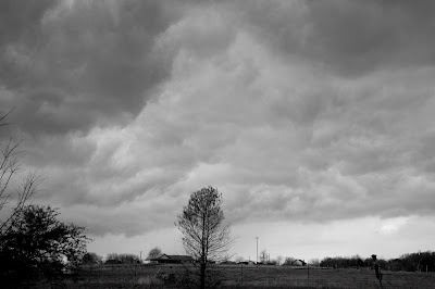
I had to work fast, because the clouds were moving rapidly across the sky, changing patterns as I watched.
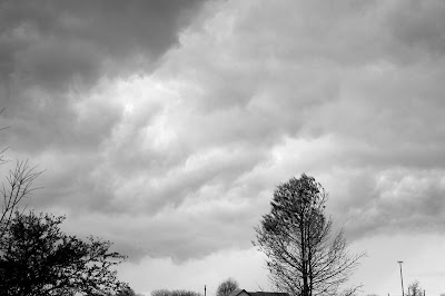
No rain yet, but it was not long before we had a nice solid shower - much needed - we are way behind in our rainfall totals over the last twelve months.
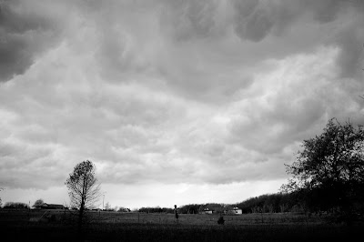
Within an hour or so, the blue sky followed behind the front. Amazing to watch God's handiwork in the weather.
As I saw the amazing clouds, I ran into the house and grabbed my camera.

I had to work fast, because the clouds were moving rapidly across the sky, changing patterns as I watched.

No rain yet, but it was not long before we had a nice solid shower - much needed - we are way behind in our rainfall totals over the last twelve months.

Within an hour or so, the blue sky followed behind the front. Amazing to watch God's handiwork in the weather.
Thursday, November 13, 2008
Ike - Integrated Kinetic Energy and Hurricane Ike
The Galveston County News has an article today by their weather reporter, Stan Blazyk, about the IKE scale - worth reading. Hurricane Ike measured a 5.6 on the scale of 1-6 on the Integrated Kinetic Energy scale. (Another article I read said Hurricane Ike measured 5.4 - still larger than Katrina) Hurricane Katrina and Hurricane Wilma only measured 5.1. While I never found the reference in Weatherwise, he mentions that Hurricane Ike was designated as the largest hurricane ever in the North Atlantic Basin. Weatherwise also has an interesting article about a reporter who followed Gustav. Hunting Gustav: A Broadcast Meteorologist's Diary which noted that the Great Galveston Hurricane of 1900 and Hurricane Ike both connected with cold fronts and re-strengthened over the midwest. It is an interesting read.
If you are interested in reading more about the Ike scale, Stan Blazyk's article provided two links. A Google search for the Ike Scale also came up with more interesting articles that have been written since Ike. I suspect that in the future, hurricane forecasters will be using the newer Ike scale in addition to the Saffir-Simpson scale to give a better sense of how much damage a given storm will produce.
If you are interested in reading more about the Ike scale, Stan Blazyk's article provided two links. A Google search for the Ike Scale also came up with more interesting articles that have been written since Ike. I suspect that in the future, hurricane forecasters will be using the newer Ike scale in addition to the Saffir-Simpson scale to give a better sense of how much damage a given storm will produce.
Wednesday, October 26, 2005
New York
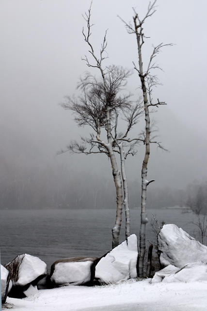
I woke up to rain this morning. Not unexpected, but still disappointing. Since taking photographs in rain is not a lot of fun, I decided to explore some new territory. I headed west into New York State. I crossed over the bridge at the far south end of Lake Champlain. The mountain on the west was beautifully colored -well worth coming back for on another trip in better weather. I drove north following the shoreline. I then headed into the Adirondack Mountains. As I went up in elevation, the rain turned to snow. I got a few winter pictures, but I was not really dressed for snow. While my suitcase was heavy, I really had packed light planning to layer. I was thinking fall, not blizzard. I drove through the Lake Placid area - seeing the ski jump site and some of the other Olympic facilities.

But hours driving in snow without my four wheel drive vehicle (think security blanket) left me a little tense. I made my mental plans to stop when it got dark. I made it to Utica just after dark.
Friday, July 22, 2005
Late Afternoon Storms
As I was getting in from Curves, we had a storm forming to the north of Hutto. I haven't really had a chance this year to sit on the porch and watch a storm come in . . . . .so I got one of the mini meals I get to eat right now - this time a low carb yogurt and went to the front porch. I could tell that the best vantage point was on the far end, so I sat on a concrete bench that came from the house where I grew up. I watched one set of clouds churn and try to spin. A small version of a wall cloud tried to form. The lighting began to get closer. I noticed my neighbor out checking the dogs and goats. I heard the goats start to call and then FLASH/BOOM!!!!!!!!!!! Out of nowhere, a big lightning bolt hit right in front of me, leaving an afterimage on my retina. The light and sound were simultaneous and, of course, I was startled. I also stepped back a few steps from my edge of the porch vantage point. That one was a little too close. Henry came out to see if I had seen it. Then I thought about Sean . . . . I had just seen him head in the direction of the barn for the goats . . . . . Oh, I hoped and prayed he was OK. A few minutes later I saw both Sean and Butch and breathed a sigh of relief that they were both OK.
The wind picked up and you could hear the rain line as it came in. We got a nice little shower that definitely cooled things off a little. Henry read his book on the porch during the rain and I enjoyed the peaceful sound of the falling rain.
In our busy, project oriented world, it is easy to stay focused on which ever task is due next. One of the paths to serenity lies in taking time to watch and appreciate nature's dramas.
The wind picked up and you could hear the rain line as it came in. We got a nice little shower that definitely cooled things off a little. Henry read his book on the porch during the rain and I enjoyed the peaceful sound of the falling rain.
In our busy, project oriented world, it is easy to stay focused on which ever task is due next. One of the paths to serenity lies in taking time to watch and appreciate nature's dramas.
Subscribe to:
Posts (Atom)